Aerial Surveys, Thermal Imaging & Roof Scans Across N.I.
Safe – Fast – Certified Drone Operators

Drone Inspections Northern Ireland

Residential Roof Inspection
Fast. Safe. Crystal Clear.
Our drone roof inspections take the risk, guesswork, and delays out of traditional roof assessments.
We provide high-resolution aerial photos and video of your entire roof — including tiles, chimneys, valleys, and flashing — without ever stepping foot on a ladder. Whether you're buying, selling, maintaining, or investigating a leak, we deliver detailed visual reports in under 48 hours.
Key Benefits:
🚫 No ladders, no scaffolding, no risk
📷 4K overhead + angled imagery of full roof area
📝 Optional defect summary report
📦 Same-day or next-day delivery available
Ideal for:
Homeowners
Estate agents
Roofers & trades
Insurance & mortgage valuations
Pricing from £99

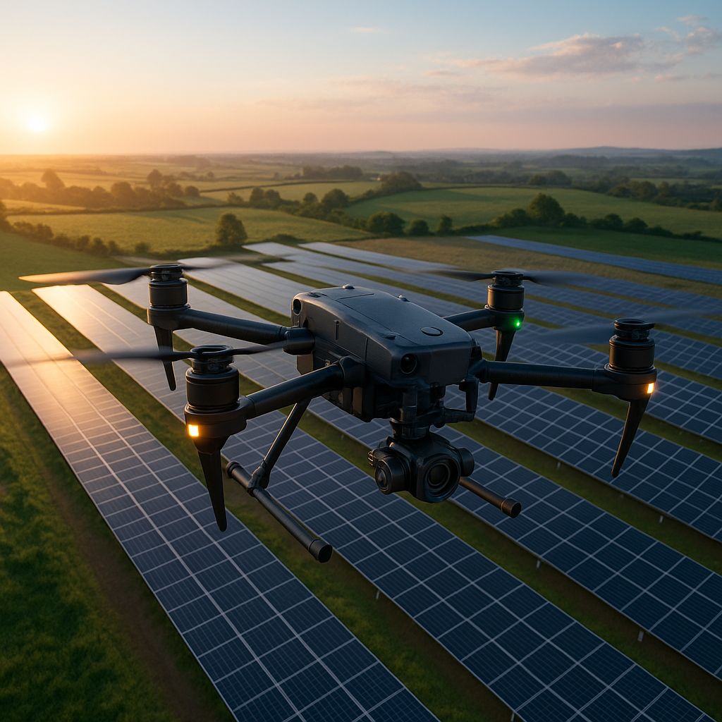
Thermal Survey
See the Unseen — in Heat.
We use high-resolution thermal cameras to detect problems invisible to the naked eye. From heat loss in roofs to failing solar panels and overloaded electrical systems, our infrared drone surveys deliver fast, actionable insights without the need for access or disruption.
Ideal for:
Roof leak detection
Insulation performance checks
Solar panel fault detection
Electrical hot spot identification
Pre-purchase surveys and energy audits
Why use VoltView NI?
📷 Industry-grade thermal imaging
📝 PDF reports with annotated heat maps
🚫 No ladders, no downtime, no risk
⚡ Results within 24–48 hours
Pricing from £POA

Advanced Service Custom
Enterprise Tools. Precision Results.
Our Advanced Services go beyond basic drone flights — delivering data-rich, high-accuracy inspections using the latest UAV technology. With LiDAR, thermal imaging, photogrammetry, and indoor navigation capabilities, VoltView NI solves problems others can’t even see.
We support:
⚡ Powerline inspections with LiDAR and thermal overlays
🏭 Indoor industrial scans — including cranes, beams, trusses & ducting
🌳 Vegetation encroachment mapping for utilities and rail
🏗 3D site modeling for construction & planning
🌡️ Multi-sensor inspections for complex structures
Built for engineers, developers, utility firms, and risk managers.
Fully certified. Fully insured. Data delivered in 48 hours.
Contact us
Interested in working together? Fill out some info and we will be in touch shortly. We can’t wait to hear from you!